


Deploy fiber and electric networks faster with verified truth at every step.
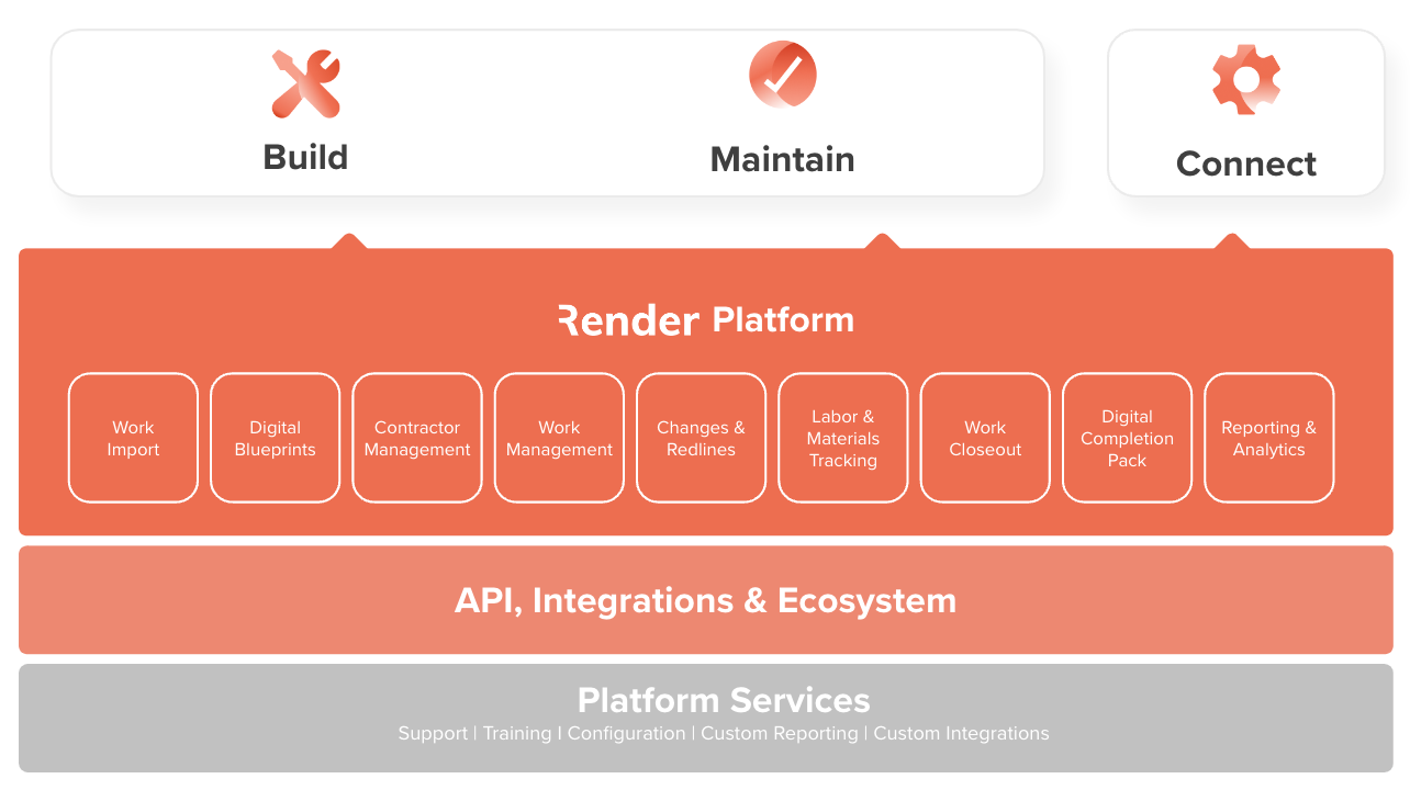
Render's system of execution, built for fiber, electric, and critical infrastructure construction, gives operators and builders a single, verified source of truth from design through operations. Boost productivity and deliver work faster.


AUTOMATED WORK SCOPE
Turn any network design into a verified, executable work
Render's blueprinting engine converts fiber and electric network designs, in any format, into sequenced, task-level field instructions automatically. Field crews know exactly where to go, what to do, and in what order, from day one of construction.
RENDER TASK WORKFLOW
Keep construction moving. Automatically.
Render's task workflow only releases work when dependencies are cleared: permits confirmed, materials available, prior tasks verified. Field teams get ready-to-execute tasks with no waiting, no manual allocation, and no construction stops caused by sequencing gaps.
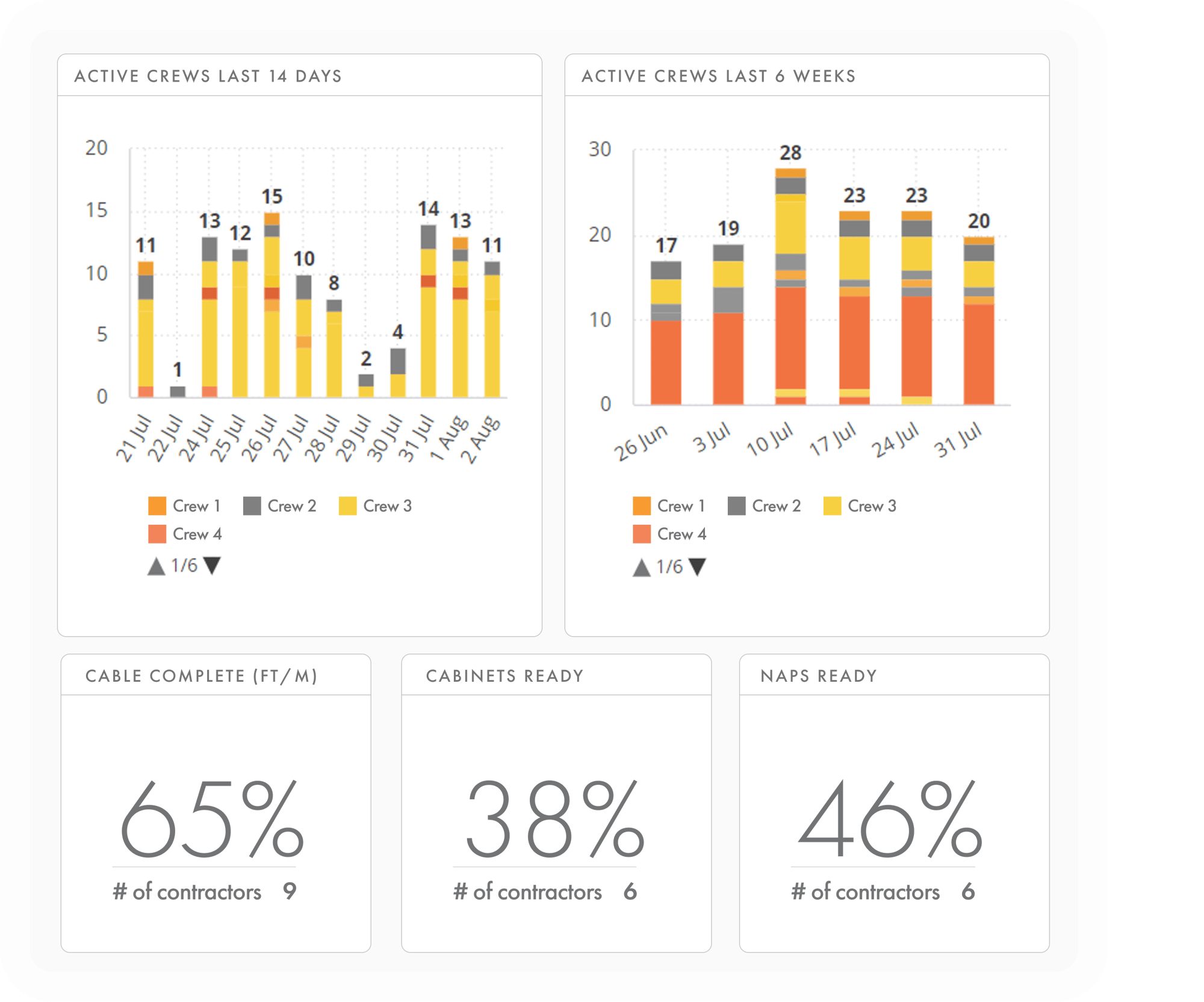
REPORTING & ANALYTICS
Manage projects with real-time visibility and insights
Gain instant visibility into progress and pace across your portfolio, forecast completions, and take corrective actions with rich, real-time data and insights.
DIGITAL AS-BUILTS & COMPLETION
Real-time as-builts. Audit-grade closeout. No rework at handover.
As field crews complete work, Render automatically captures digital as-builts and passes structured closeout data to downstream systems like OSS/BSS, GIS, payment, and permitting, all in real time. Handover is continuous, not a project-end scramble.

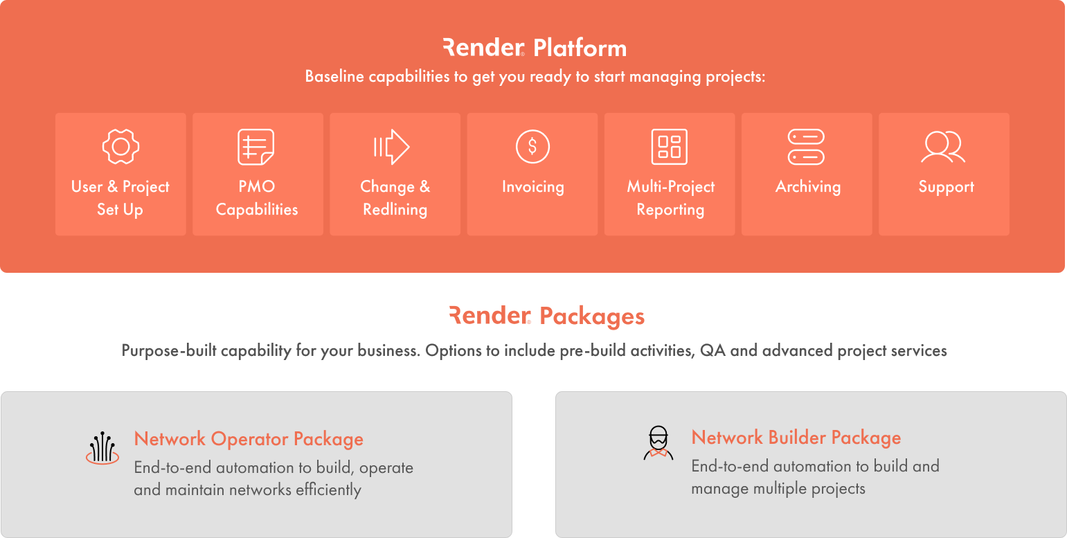
Strategic work management
Streamline the management and tracking of work from design to construction, connections, and ongoing maintenance. Release, complete, and approve tasks to monitor the progress of all work in real time.
Scheduling and forecasting
Accurately predict the completion dates of individual tasks, construction areas, and ultimately the entire project or portfolio daily, using historical or planned resources and productivity rates.
Redlining and change management
Efficiently manage all changes and redlines in real-time while in the field, ensuring a complete and accurate record of all work on the network.
Quality assurance
Review and validate actuals vs, planned work and photos captured as work is completed. Automatically trigger additional QA tasks based on deviations from the plan, critical task review, or simply adhering to standard procedures.
As-built completion pack
Progressive close-out data is securely passed to downstream systems throughout construction to accelerate customer, payment and operations processes.
Customer drops
Dynamically create and automate construction and customer connection workflows. Optimize tasks based on subscriptions and install dates.
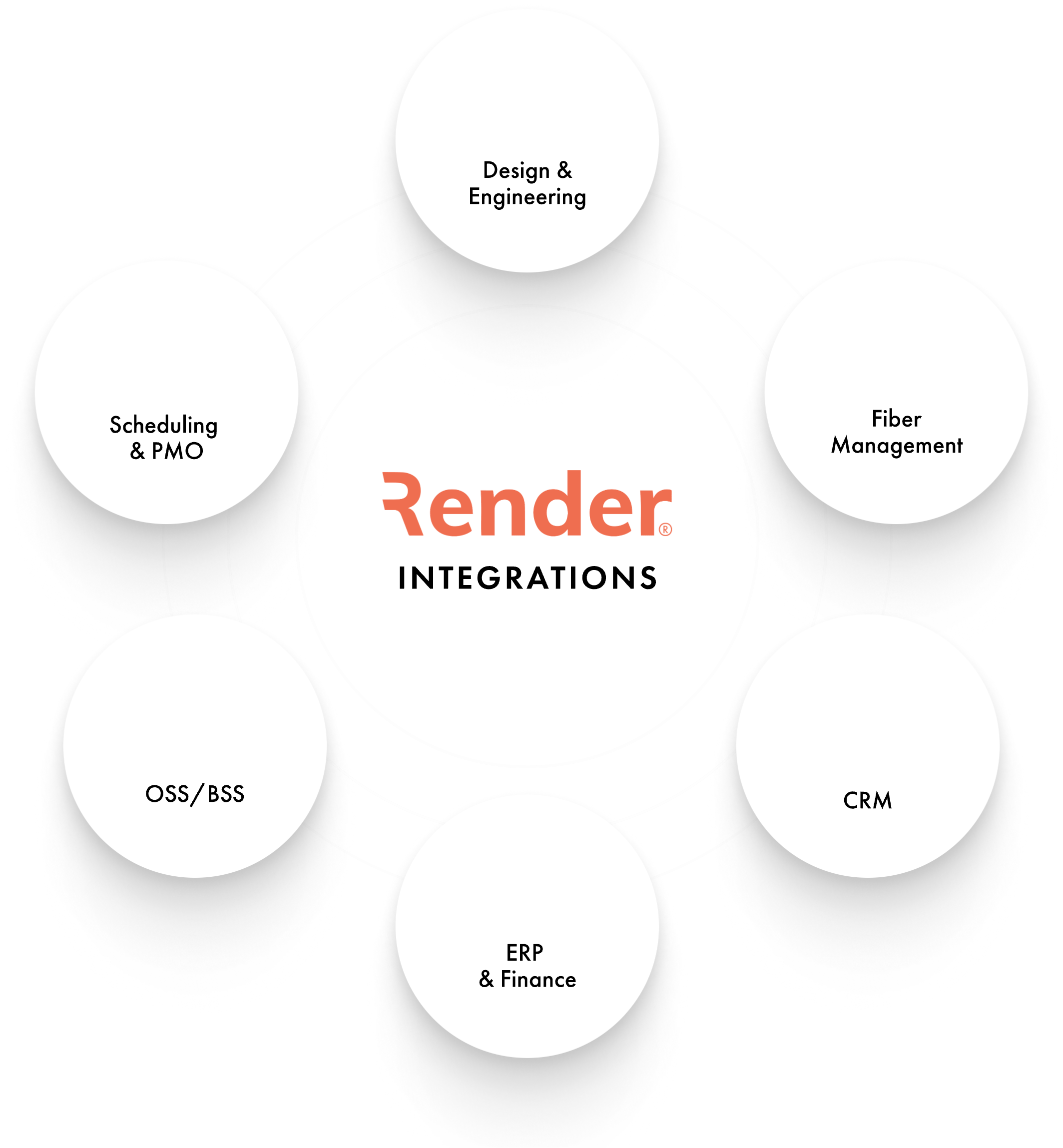
One source of verified truth, connected across your entire infrastructure ecosystem
Critical infrastructure network operators (fiber, electric, and beyond) need field data, financial systems, GIS platforms, and operations tools working from the same ground truth. Render's open API and integration infrastructure connect virtually any data source, including OSS/BSS, permitting, inventory, payment, into a single, real-time operational record.

Industry experts choose Render
Render’s platform has been a game changer for our organization. Right now, we’re about six months ahead of schedule just 18 months in.

BILLY GORDON
VP, Technical Operations

You’re in good company


OUR SOLUTIONS
What type of work are you looking to streamline?
GET IN TOUCH
Deploy critical infrastructure networks faster with verified execution from day one.